Tuesday, May 31, 2011

Review: Bon Echo Provincial Park - Abes & Essens Backpacking Trail

Location: 70 km North of Napanee
Website: Ontario Parks
Camping Facilities: Backcountry (hike-in only)
Grade: C+
Stargazing: Excellent
Summary: An uneventful, rugged hike leading to forgettable, swampy lakes. Better off going to Joeperry/Pearson
Essens Lake Bon Echo Provincial Park
View of Essens Lake at sunset
Thoughts: I like Bon Echo as a park, given its natural beauty, the big rock, the pictographs and its proximity to major urban centres.  However, that's also the reason you can't find a car camping site here in July and August (even though it has 528 car campsites, which is large by Ontario standards).  On top of that, most of the car camping in this park is beyond terrible.  So to enjoy this park, I opt for the less popular Joeperry Lake.  But one year, my regular camping companions and I thought we'd try something new in Bon Echo, the even less popular Abes & Essens Backpacking sites.  I'm sure you'll have  no problem booking these, no matter what time of year.  They're not extraordinarily difficult to get to, but the hike is probably beyond the imaginings of "weekend fun in the outdoors" for most Bon Echo campers.

View from a campsite on
Essens lake - note: swampy

There are two sites within a reasonable trek from the trailhead, both of which are at Essens lake.  Our site at Essens was a swampish pond of a lake, with bugs to match.  The lake is just really small and mucky. We tried to scoop some water that we could filter and drink, but found whatever we scooped up was black with silt and organic matter.  I don't know if you could have even settled the stuff out, this water was really thick.  There were also plenty of leeches to keep us company on our swims.  The site itself was on a bit of a slope, but there was a reasonably flat stretch to pitch the tent.


Essens Lake Bon Echo Provincial Park
More swampiness on Essens
For its scenic value, the Abes/Essens trail is not worth the effort.  Even the park's literature describes the sights as "intriguing"; that doesn't strike me a strong endorsement, considering the hyperbole that's generally infused into park publications. Admittedly, the camping was at least peaceful;  not a single person in the park thought it would be a good idea to hike this trail, even in peak season.  We didn't see another soul the entire weekend.  So if you want solitude, you'll find it at Essens Lake.  And I'm willing to bet you'll find greater solitude at Abes Lake, given the distance that has to be covered to get to the sites there. Frankly speaking, the hiking trail that loops around Essens doesn't have much to offer in the way of scenery, perhaps that changes when you get up to Abes.  But I have my doubts and I don't know if its would be worth the effort to ever find out.

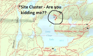
Abe-Essens Trail Map
 (Source: Bon Echo Park Tabloid,  2008)
Addendum:  Judging from this interesting hiking log, the trip up to Abes is not worth your time.

Sunday, May 29, 2011

Review: Banff National Park - Castle Mountain Campground

Location: Along Highway 1A, 30 km NE of Banff
Website: Parks Canada
Camping Facilities: Car Camping
Grade: B
Stargazing: Mountains and canopy made it pretty difficult. You can't have it all.
Summary: Car camping offers limited privacy, but the quality of scenery (mountains, streams) in the campground makes up for it.  Great location halfway between Banff and Lake Louise.  Plentiful wildlife viewing opportunities. 
Comfort station at Castle Mountain Campground
Thoughts: Albertans have it pretty good; energy resources, plentiful agricultural land, a strong economy, winning hockey teams (well, at least within the past few decades).  And on top of that, Alberta just happens to have some of the most beautiful and accessible scenery in the country!   Come on, guys!  At least Albertans are generally friendly as well, else us Ontarians would have to grumble and pout about it even more than we do.  (**Please note, if you're used to seeing mountains and they don't strike you with awe, then you'll probably hate this place)

Even the car camping is disproportionately nice here.  Sure, the sites are close together, there's no privacy, but the raw beauty of it all is too overwhelming.  Just look at site 21 below.  Yes, that's a stream flowing through the site.  And look at the view up to the comfort station (which has both hot water and flush toilets).  Its just ridiculous.

The other beauty thing about this campground is that its pretty central.  Just a short drive over to the Trans Canada highway, then 30 km to Lake Louise, and 30 km to Banff.   You can even jet up the Icefields Parkway and see rest stop after rest stop with indescribable look-outs (see below).  Pictures do not do this place justice 

Campsite 21 at Castle Mountain Campground
Hiking: While the time I spent in the wonderland was far too brief, I was able to do a few quick hikes.  Plain of the Six Glaciers is incredible (and can probably be labeled a novice hike).  If you do the entire length (hike 30 mins past the second tea house), you will be rewarded with an outstanding view in all directions.  The second was Johnston Canyon, which was nice and all, but I didn't make it past the upper falls (which is where most other tourists make it, so its a very crowded trail).  Perhaps treking up to the Inkpots would have been more rewarding.  The final hike was a very short but extremely rewarding hike just off of the Peyto Lake viewing platform.  If you head further along the trail, past all the tourists, you'll reach a loop that takes you around for some further viewing.  There are some side trails here that have equally outstanding views of Peyto Lake, while providing complete seclusion (people tend not to stray far from the viewing platform).

Peyto Lake Banff National Park
Peyto Lake, along the Icefields Parkway
Chateau Lake Louise Plain of the Six Glaciers
View of Chateau Lake Louise
from Plain of the Six Glaciers

Review: Canoe-In sites, Gurd Lake, Grundy Lake Provincial Park

Location:  80 km N of Parry Sound
Website: Ontario Parks
Map: Google Maps
Camping Facilities: Car Camping with some pseudo backcountry
Grade: B-
Stargazing: Good, in fact we saw the Northern Lights from our site, but that was likely a freak occurrence.
Summary: Some very easy-to-access backcountry but some sites close to beaches & railroad, eliminating any sense of wilderness
grundy lake provincial park
Backcountry Site Map of Grundy Lake
 (From Park Tabloid, 2005)
Thoughts: My visit to Grundy Lake was an accident.  We'd booked a stay in the Massassauga Provincial Park a little south of here, but the winds were obscene.  Our group were not big on getting swamped and spending the remainder of our weekend drying off, so we hit the map books and found that Grundy Lake wasn't too far away.  We gave them a call, cause the paddle-in sites were non-reservable (first come, first served basis), and found out that there were still plenty of sites available (on labour day weekend, no less).

For pseudo-backcountry, Grundy's sites have it all:  short paddles, easy access, some isolation, nice sites, and its reasonably quiet.  We actually saw the northern lights on our first night.  Our group will exploit luxury when we can get it, so when we figured out that a vending machine and newspaper box were just a 500m paddle away, we took full advantage.  There's something about a cold Coke and a newspaper on a hot afternoon when you're sitting next to a lake listening to the wind in the pines.

I would imagine that if you're staying on Pakeshkag Lake, the level of seclusion would be on par with some of the larger backcountry parks in Ontario.  However, looking at the map above, you'll notice that the more secluded sites are generally closer to train tracks, which leads my discussion to the major issue with this park: the trains.  While they aren't that frequent, they're usually the long freight trains. So, in the wee hours of the morning, you'll hear them chugging along, often blowing their horns, and rumbling down the tracks for a few minutes at a time. I would be surprised if you don't wake up at least once during the night.  We stayed on Gurd lake, whose sites aren't even some of the closest to the tracks, and the sound of the trains brought to mind the realization that you aren't really in the backcountry, you're just faking it. 

Review: Algonquin Park - Canisbay Campground

Location: 50 km east of Huntsville
Website: Ontario Parks or Friends of Algonquin Park
Map: Google Maps or Canoe Routes
Camping Facilities: Car camping and Canoe-in sites
Grade: B
Summary: Decent car camping, especially walk-in sites, canoe-in sites provide a decent pseudo backcountry experience without much additional effort
Thoughts: The sites here are pretty nice for car camping.  There has been some effort to increase spacing and improve understory growth.  However, it's car camping, with all the usual failings - lack of privacy, noise as loud as your neighbors desire (which can be low or high, but usually is higher than I like), and limited scenery.  One important feature of Canisbay is its fantastic beach; the lake bottom is sandy, the water is shallow for a good few dozen meters off the shore (read "kid friendly") and it's clean and weed-free.  We thought we'd make a return trip back to the beach at night for some star gazing, but we weren't the only ones; there must have been a few dozen others, with varying degrees of consideration of the enjoyment of fellow sky-watchers (some folks speaking softly, others loudly displaying their ignorance of the night sky...a classic chestnut of wisdom "If you draw a line from Orion's belt and one from the handle of the big dipper, they will intersect at the North star"...actually, that's total hooey).  And this was at midnight and park wardens didn't seem to mind, so who knows how late into the night the loud, nonsensical babble can go.

This campground would be yet another car-camping lost opportunity if it weren't for the provision of two key alternatives: walk-in and canoe-in campsites.  The beauty of the walk in sites is that you're aren't sleeping right next to your car, the sites are reasonably well spaced out, in the radio-free and dog-free zones, and many are close to the water (20-23, 72,73,75).  A point to note - just because a site is radio free doesn't mean that it's "drunken yahoo" free; I've been woken up by rowdies wandering the campground in an intoxicated haze at 3am here.  I recommend snatching up a walk-in site as quickly as possible, they're pretty popular.  What disturbs me is the price of these sites; $40 per night in 2011.  We're approaching Motel 6 rates here guys.


algonquin park canisbay campground
View from waterfront at Canisbay Campground 1 
If you have a smaller party, a cheaper alternative (if you already own a canoe...) is to make use of one of the 16 canoe-in sites on Canisbay lake.  These are ~$12 per person, per night (2011).  If its just two people and you don't have to pay for a canoe rental, you'll save a few bucks and these sites have much of the solitary vibe that one seeks in a backcountry site.  On top of that, you can probably lug some luxury items (camping chairs, car camping tents, firewood) along with you since you can dump them straight into your canoe from your car (no portages!)

Saturday, May 28, 2011

Review: Algonquin Interior - Hilliard Lake

Location: Off of Highway 60, Access Point #8 (Cache Lake)
Website:  Friends of Algonquin Park or Ontario Parks
Map: Google Maps or Canoe Routes
Camping Facilities: Backcountry Exclusively

Stargazing: Excellent
Summary: Nice, small lake.  If you can book it, you'll have it all to yourself, but there's not much to do here and canoe traffic during the day.
Grade: B+
Thoughts: There isn't a whole lot that that needs to be said about Hilliard (and I've lost all my photos, sorry folks).  This lake showed up on my radar after I noticed that there was just one reservable campsite on it, yet it was relatively easy to access (just a single portage in, which was less than a kilometre); a perfect spot for a base camping trip.  The portage in was pretty flat and reasonably clean, which is a relief after the boring paddle across Cache.  The single site was not bad, fairly large (enough space to toss around a frisbee), and there wasn't that much traffic passing through, even during peak season.  However, the lake isn't all that well connected, so potential day trips likely won't be too attractive unless making a lot of portages to a chain of really small lakes interests you.   The bottom line is that at night time, you'll have it all to yourself, so you can be as loud or appreciate the quiet to whatever degree you desire.  This is a good option for solitude without much work.


Review: Algonquin Interior - Kingscote Lake

Sunset on Kingscote (from NW site)
Location: 1 hr northwest of Bancroft
Website: Friends of Algonquin Ontario Parks
Map: Canoe Routes Map Google Maps
Camping Facilities: Backcountry exclusively
Grade: B
Stargazing: Excellent, watched Persieds from here.
Summary: Nice enough
Thoughts:  This was a one-nighter for me, just a quick get away to have a look at the Perseid meteor shower back in 2007.  It was an ideal meteor watching night, with no clouds in the sky, and barely any moon to drown out the night sky. The only real challenge was that my camping partner and I were driving each other nuts, arguing over camping practices and etiquette, nearly coming to blows at one point in the middle of the lake over how much talking is acceptable when canoeing at night. (I know, petty, but it seemed really contentious at the time!)

This is a part of Algonquin that is a bit of a mystery to me.  Even though it's at the southern-most tip of Algonquin park, nobody goes here because you'd have to rely on slower two-lane highways to get you to the park (the Highway 400 is of little use here).  Hence it takes a little longer and there are fewer access points (limiting the number of trip options).  But we were already in the Ottawa Valley, so it made for a reasonably good stop over with a reasonably dark sky.

NW-most site on Kingscote
The access point is a bit of a funny one, where you purchase your permit just south of the access road to the park (do that first, so you don't end up driving to the put-in only to find that there's no permitting office).  The permit office is actually within a trailer campground, so you can pick up a few last minute items as well (I recall there being maps, bait and snacks). Then you trek back up north (15-20 min drive) to the Kingscote put-in.  The lake itself is nothing to write home about (see the images), but it was relatively peaceful for us despite there being a few cottages on the lake.  We stayed at the northwestern most site, which is pretty isolated, and you don't really have a view of many other sites.  It's not one of the best sites we ever stayed at, and we definitely needed to paddle out into the middle of the lake to get a better look at the sky.  However, it's pretty spacious as you can see from the photo.
Kingscote Lake

I'd like to go back in sometime to explore the York River and the Scorch Lake hiking trail, to see if there is more of interest in the southern part of the park (it's not exactly well-kept either, with many of the lakes further up the "stem" of the park having low maintenance frequencies).

Anyways, if nothing else, you now can see a few images of the lake and the site on the northwestern bay (have a look at the map).  This part of the park doesn't have much in the way of scenery, nor seclusion on this lake, but might be worth investigating further into the park. 

Review: Bon Echo Provincial Park - Joeperry Lake

Location: 70 km N of Napanee, ON
Website: Ontario Parks or Friends of Bon Echo
Map: Google Maps
Camping Facilities: Canoe-In / Backcountry Lite
Grade: B+
Stargazing: Excellent
Summary: Great backcountry experience for novices, easy access, some sites are densely clustered, but generally tolerable

Joeperry and Pearson Lakes Map
(Source: Bon Echo Park Tabloid, 2008)
Thoughts: If you're looking for a pseudo-backcountry experience without much work, Joeperry is a good option. I've been taking first-time campers here for years and I don't think I've had one person come away disappointed. It's a big enough lake to allow for a good number of campsites, but small enough that paddling to them isn't a battle.

There's an easy 500m portage to the lake, along a wide access road that has a few ups and downs (the steepest hill is right at the end, approaching the water, but you walk downhill when going into the lake, which is a relief). As well, there's a decent little beach at the north end of Joeperry.  There are usually a few families of loons that are active on this lake, plentiful deer (have had morning visits on my site on occasion), mischievous raccoons, and a pack of coyotes (often audible at night), which add an additional wilderness element. There is even some bear activity from time to time, so you'll want to hang your food properly (a cooler with a few heavy rocks on it won't cut it).

Bon echo provincial park joeperry lake
Joeperry lake from site 508
Regarding the sites - some are a touch close together, but generally you can't see other campers. You can often hear other campers, but it's a reasonably big lake, so the noise shouldn't be a big disturbance. All sites have a privy box, firepit, and picnic tables. Sites 503-511 have some positive and negative points (like all things in life).  The closest sites are all adjacent to you, so you can't see them; unless your neighbours are noisy, you will hardly know anyone else is around.  These sites can be rocky and some are difficult to dock at without getting your booties wet. That being said, they're generally the last to be booked so unless you plan early, these sites may be the only options available (though my point is that it isn't a terrible thing). Additionally, they're all connected by a footpath, so if you have a very large group, you can easily access each other's sites without having to get back into your boat.

The island sites (especially 520) are very popular, though inexplicably so in my opinion.  520 gets a lot of traffic around it from people trying to reach the 503-511, in addition to curious paddlers just exploring the lake. As well, 520 is on a slope and it can be difficult to find good spots for multiple tents. Sites 522 & 523 are flatter (though smaller as well), but we've had issues with raccoons here (heck, we've had issues with raccoons all over this lake).

Pearson lake, which is connected to Joeperry, is a reasonable option, though accessing it can be difficult. You either head south from the dock through a maze of reeds (navigable, but it might get tricky in low light) or go the long way around the island. It is a nice lake and the sites feel more remote, so if you're not arriving too late in the day, you might want to consider Pearson.

Overall, I do recommend Joeperry. It was my very first canoe-camping experience, and it changed my whole perception of what camping can be. While seasoned canoe-campers won`t find much challenge or adventure going to Joeperry, it`s probably one of the best places to take new campers to show them the wonders of Canadian shield country.

Hiking: There is only one hike in this park that I can recommend and it`s the Cliff Top Trail. Great view from the top of the rock (you have to pay to be ferried across to the trail, just a few dollars though). The Shield trail is incredibly boring with very few sights. The "lookout" towards the end of the trail was sub-par, mostly obstructed by trees. Don't even bother with the Abes and Essens Lake trail. I've hiked the 9km loop and, while mildly challenging due to its length, it is a let down. Not much scenery to be found and it can be very buggy.

Carvings of Walt Whitman Poetry
 on the Bon Echo Rock
Paddling to the Bon Echo Rock


Friday, May 27, 2011

Review: Little Clear Lake, Frontenac Provincial Park

View from site on Little Clear Lake
Location: 50 km North of Kingston, ON
Website: Ontario Parks or Friends of Frontenac
Map: Google Maps
Camping Facilities: Backcountry Exclusively
Grade: C
Stargazing: Not bad, you get light pollution from Kingston though.
Summary: Easy to access, great backcountry experience for novices, sites are too close together
Thoughts: This park is great for people new to the backcountry, it's pretty easy to access off Highway 401, and there are some pretty good hiking trails too. Heck, even the drive to this park is nice. But the bottom line is: the camping stinks.

If I were to tell you that the planners of this park thought it was a good idea to limit the number of sites on each lake to 4 (though Big Salmon, which is a large lake, has 10), you'd probably think that sounds pretty good. I thought it sounded pretty good. But once you see the map, you'll notice where this planning went awry; all the sites are clustered together in groups of 4, no more than 10-20m apart. So essentially, its a little bit of car camping magic in the backcountry, except with none of the luxury and all of the work. So if you camp on a full lake, you better be in a sociable mood.frontenac provincial park camping ontario

I'm not sure of the reasoning behind placing all the sites in clusters. Maybe they wanted to contain the environmental degradation that is associated with setting up camp to smaller pockets. Maybe they thought it facilitates social interaction (maybe that sounds attractive to you and I'm just being a presumptuous jerk about it). But clustering the sites just seems like a waste, given the limited backcountry camping opportunities that exist within a reasonable drive of Southern Ontario's urban areas.

Hiking: I recommend the Doe Lake hiking trail for a few reasons: its got a nice lookout which the park staff have lugged a bench up to, there are some beaver ponds along the way, and you spend a good amount of time walking by the water on the first half of the hike, as well. My only suggestion is that you double back after you reach the look-out bench; the second half of the hike just meanders through forest with nothing interesting to see, so you will be bored (unless you're a tree biologist).

From the park map, I can see that the sites on Buck Lake are just barely contained within the park, with the rest of the bay being private property.  I'll take that to mean that they'll be sharing their wilderness experience with cottagers with power boats.  So it seems the southern part of the park is completely shot.  I'd be very interested to hear people's comments on the more northern parts of the park, do they salvage the lame camping set-up?

Some notes from my limited experience with the park (limited because its just not worth repeat visits):

-Big Salmon Lake: can get chopping due to its size and orientation, but a nice paddle
-Little Clear Lake: The portage in from Big Salmon is a bit hilly and rocky (hence dangerous when wet), but bearable in length. The sites here can be breezy which is good for bugs, and are generally well shaded. See above for an image from a site on Little Clear Lake.


Portage Descriptions (from Park Tabloid, 2011)


Tuesday, May 24, 2011

Review: Samuel de Champlain Provincial Park

Location: near Mattawa, ON
Website: Ontario Parks
Map: Google or Google Maps
Camping Facilities: Car camping, with backcountry camping just outside the park on the Mattawa River
Grade: C-
Stargazing: Probably pretty good, if you can find a decent viewpoint.
Summary: Very little privacy, densely packed sites, poor enforcement of regulations, some good hiking
Thoughts: We stayed at site 167, which was a decent site, relatively close to a water tap, the beach and an outhouse (with flush toilets, and really clean...and it wasn't a comfort station either).  That's about all the good that can be said about the site.  I feel that the only way you might really appreciate this park is if you've never seen a forest up close before.  Otherwise, it's a typical car camping experience with sites that are pretty close together, and in full view of one another. There were plenty of folks being obnoxiously loud after quiet hours (using radios, general drunken behaviour), so it gave me the impression that even on a Victoria Day weekend, staff didn't really care to enforce park regulations.  I don't recommend this park for camping, and it doesn't have much in the way of scenery either. The better way to go is the Mattawa River canoe route, which is, from what I've heard, more scenic and less "blargh" in general.

Hikes: The Etienne "Geology" hiking trail is pretty nice. Nice enough to make a trip specifically to this park?  I vote "nay".  The loop that you do probably doesn't matter other than length of time you want to spend, there's no interpretive component so the names of the trails don't mean too much. Ours had three decent lookouts, two earlier on and one about 3/4 of the way through the hike (counterclockwise direction).  Bring your bugspray.